Journey with Confidence RV GPS App RV Trip Planner RV LIFE Campground Reviews RV Maintenance Take a Speed Test Free 7 Day Trial ×


Go Back   Hi-Lo camper travel trailer forum > Hi-Lo Lifestyle > Travel and Adventure
Click Here to Login
Register FAQ Community Calendar Today's Posts Log in

Travel and Adventure Road trips, great camping spots and trip planning. Share your camping adventures, recommendations and pictures.
Reply
 
Thread Tools Search this Thread Display Modes
 
Old 11-02-2023, 12:54 PM   #1
Site Team
 
JackandJanet's Avatar
 
Join Date: Jul 2010
Location: Pine, AZ
Posts: 4,692
Default My Recent Trip to Utah

I recently returned from a trouble-free camping trip to southern Utah. I camped at Kodachrome Basin State Park which, for those of you who do not know, got its name from a National Geographic visit in 1948 when the explorers were impressed with its colorful geology and photogenic properties. The name was later changed to Chimney Rock State Park due to concerns about copyright infringement, but Eastman Kodak later granted permission to use the name "Kodachrome". My campsite was in Bryce View Loop, no hookups and very pleasant.

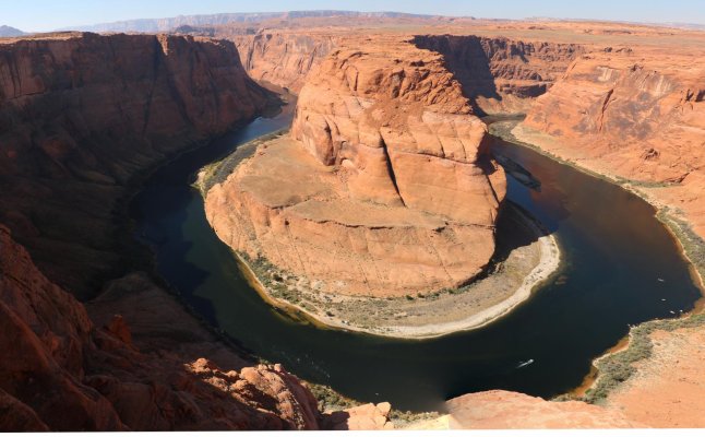
I stopped on the way in Arizona for a short hike to Horseshoe Bend, on the Colorado River just south of Page. The first picture is of that landmark.

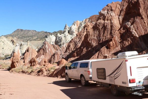
In Utah I drove up a 40 mile dirt road named "Cottonwood Canyon Road". Very scenic but also very rough in places with some very steep ups and downs. The truck and trailer handled this ok, but everything was on the floor in the trailer when I arrived at Kodachrome. The second picture is the Cottonwood Canyon Narrows along this road. The road looks good here, but there is a very steep, rough patch at the end and my wheels were slipping a bit, even in 4-wheel drive.

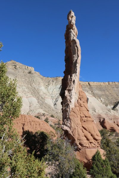
The third picture shows one of the many "chimneys" in the park. These features are "sandpipes" and are believed to be unique to this park.

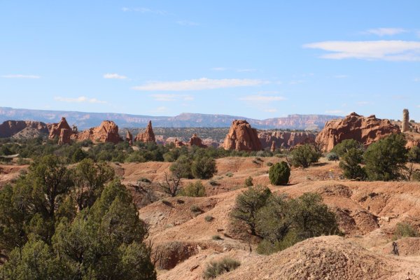
The fourth picture is one view from my campsite, and you can see more of these chimneys.

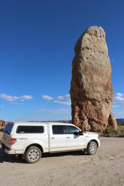
The most impressive one, though, was just east of the park, all by itself in the plain. This is "Chimney Rock" and it is 170 feet tall! You can drive right up to it.

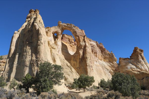
Then, about 12 miles back down Cottonwood Canyon Road, you can visit Grosvenor Arch, one of many stone arches in this part of Utah. You can walk right up to it on a paved path, about 1/2 mile long, that leads from the parking area. It is a double arch, about 150 feet high, and was named for the first full-time editor of the National Geographic magazine.

More in the next post.

- Jack
Attached Images
File Type: jpg Untitled_Panorama1.jpg (219.1 KB, 6 views)
File Type: jpg IMG_1702.jpg (297.3 KB, 6 views)
File Type: jpg IMG_1708.jpg (297.5 KB, 5 views)
File Type: jpg IMG_1704.jpg (267.4 KB, 5 views)
File Type: jpg IMG_1713.jpg (186.0 KB, 8 views)
File Type: jpg IMG_1720.jpg (267.8 KB, 7 views)
__________________

__________________
Hi-Lo 1707T - Tire Minder TPMS on Tow Vehicle and Trailer, 300W Solar Battery Charger, Equal-i-zer WDH, Progressive Dynamics Converter, Fan-Tastic Fan, LiFePO4 battery 12V DC Electrical System, SoftStartRV mounted on A/C
2024 F150 Platinum FX4 3.5L PowerBoost SCrew
JackandJanet is offline   Reply With Quote
Old 11-02-2023, 01:33 PM   #2
Site Team
 
JackandJanet's Avatar
 
Join Date: Jul 2010
Location: Pine, AZ
Posts: 4,692
Default

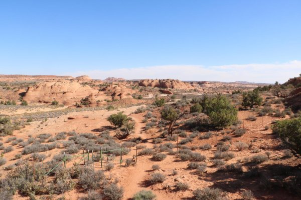
If you're still with me, I attempted to take a hike through Peekaboo and Spooky slot canyons, I wasn't successful, but I'll show you what I DID do anyway. The trailhead is about 22 miles down "Hole in the Rock Road", east of Escalante, which is near the northern end of Grand Staircase National Monument. The first picture is near the first part of the trail, very "exposed".

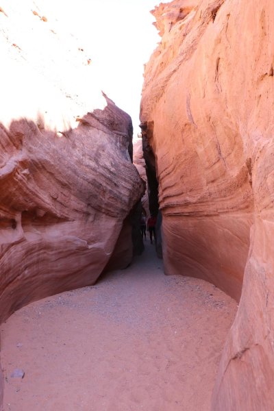
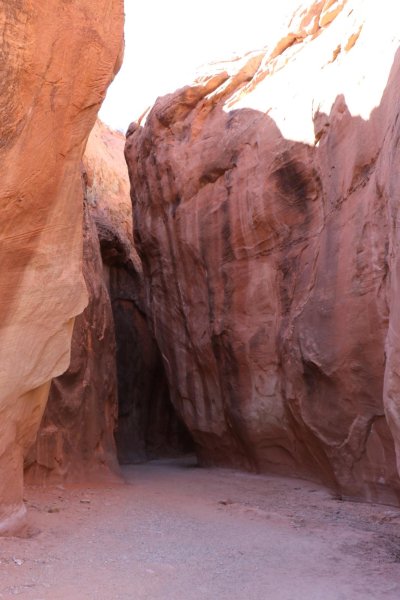
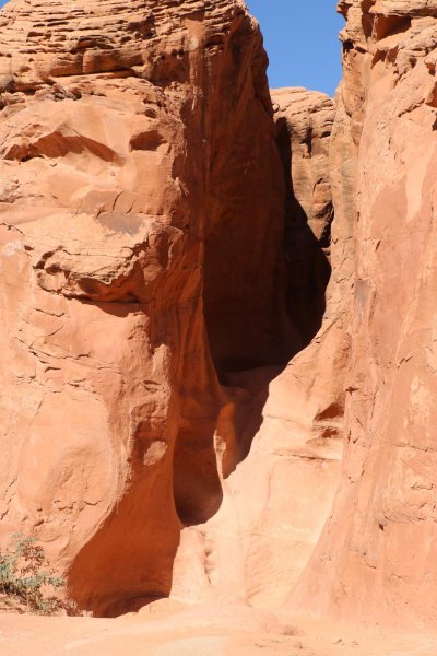
But then, you drop down into Dry Fork Wash, another slot canyon that's between 1/2 miles to 3/4 miles long. The next two pictures are inside that wash. The fourth picture shows the exit of the wash and the walls are quite high here.

The fifth picture is the entrance to Peekaboo. This was up a nearly vertical rock face to the opening in the shadows at the top and was more risk than I felt able to do. There ARE a couple hand and foot holds on the wall, but they are badly weathered and I did not feel safe to make the 12 foot scramble. Sad, because I really wanted to go in there, and it's a one-way trip into Peekaboo, then into Spooky.

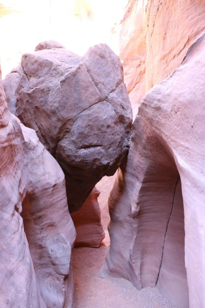
So, I walked on down to the exit of Spooky and that's what you see in the next to last picture. I DID go under the rock into the canyon, but then would have had to slither on my belly through the next opening pushing my pack and camera ahead of me, going against traffic if anyone was coming out. So, I stopped there.

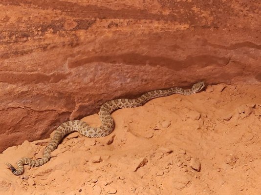
However, I met up with the pretty, 2-foot long rattlesnake you see in the last picture, near the exit, so the trip wasn't a total loss. It was rattling constantly, telling me to not come too close.

Overall, it was about a 5 mile hike and I was a bit tired afterwards.

More in the next post.

- Jack
Attached Images
File Type: jpg IMG_1728.jpg (296.8 KB, 4 views)
File Type: jpg IMG_1733.jpg (228.8 KB, 4 views)
File Type: jpg IMG_1735.jpg (200.6 KB, 4 views)
File Type: jpg IMG_1740.jpg (172.7 KB, 3 views)
File Type: jpg IMG_1739.jpg (240.4 KB, 3 views)
File Type: jpg IMG_1737.jpg (223.8 KB, 4 views)
File Type: jpg 20231024_131348.jpg (253.7 KB, 4 views)
__________________

JackandJanet is offline   Reply With Quote
Old 11-02-2023, 02:17 PM   #3
Site Team
 
JackandJanet's Avatar
 
Join Date: Jul 2010
Location: Pine, AZ
Posts: 4,692
Default

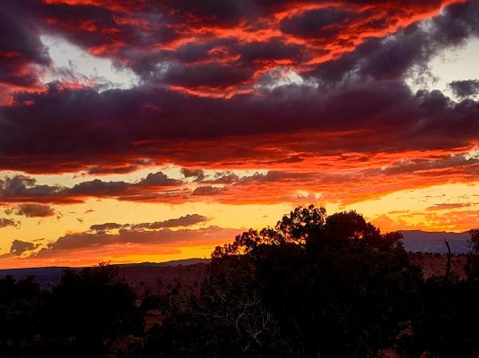
That night, I had a rather beautiful sunset, that I took a picture of. I thought you might enjoy it as well.

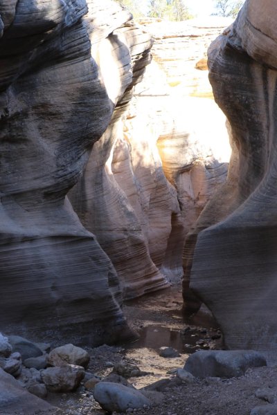
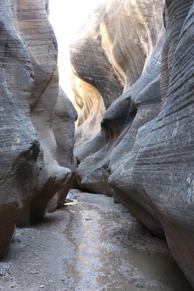
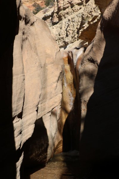
Have you guessed I like slot canyons? The next day I took a stroll through Willis Creek Narrows, which is about 15 miles west of Kodachrome. The first picture is where the narrows really starts, at a small waterfall and then the next ones are along the canyon. It goes in and out of narrow spaces for about 2 miles. It's quite an easy walk, very level, but you DO have to cross the creek many times, so your feet get a bit wet. I love the shapes of the rock walls.

The last picture is one of the exits of a "narrows" portion.

Different subject next.

- Jack
Attached Images
File Type: jpg 20231022_184552.jpg (191.1 KB, 2 views)
File Type: jpg IMG_1748.jpg (180.7 KB, 2 views)
File Type: jpg IMG_1749.jpg (212.3 KB, 2 views)
File Type: jpg IMG_1750.jpg (284.5 KB, 2 views)
File Type: jpg IMG_1759.jpg (312.7 KB, 2 views)
JackandJanet is offline   Reply With Quote
Old 11-02-2023, 02:54 PM   #4
Site Team
 
JackandJanet's Avatar
 
Join Date: Jul 2010
Location: Pine, AZ
Posts: 4,692
Default

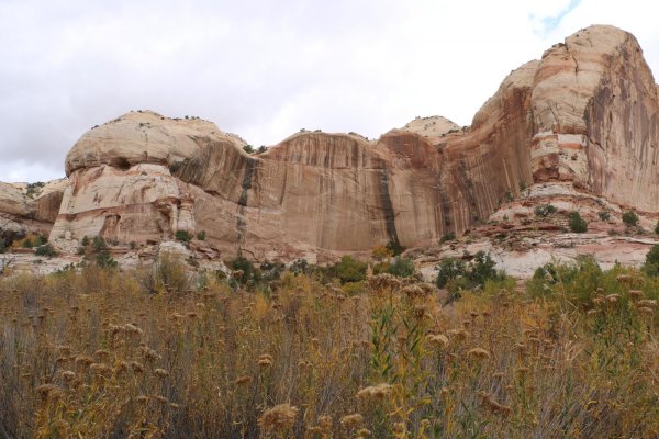
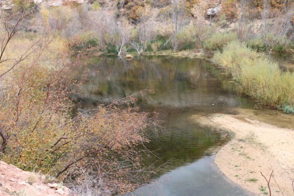
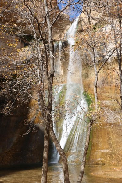
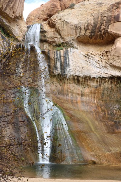
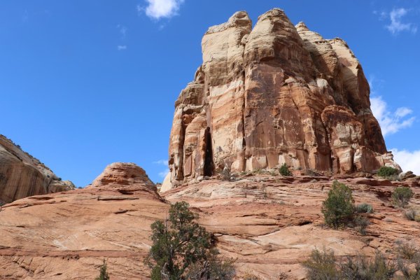
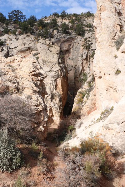
One of the most photographed features in this area is the Lower Calf Creek Falls. It is at the northern end of Grand Staircase - Escalante National Monument and you get to it by hiking 6 miles round trip. Sadly, much of it is through very fine, deep sand, so it is kind of a demanding hike. It also goes up and down all the way, and I hate going "up". Still, I love waterfalls, so I did it. These are pictures I took along the route and at the falls.

The walls of the canyon on the way to the falls are quite high and the patterns on the rock are very beautiful to my eyes. In the second picture, I show you a beaver pond that is along the way. There was a male and female Mallard duck in the pond.

The falls themselves are rather spectacular. They are about 120 feet high and cascade down the rock face at the end of the box canyon. You get right to the base of the falls and people swim in the pool at the base. In fact, a middle-aged woman stripped down to her underwear and went in. It looked much too cold to me, so I didn't try that.

Utah has some impressive rock formations in this part of the State, and the next to last picture is one I photographed on the way back from the falls.

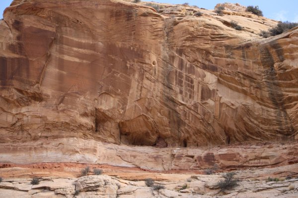
The last picture is of a "grainery" (grain storage place) that was made by the Native Americans about 1,000 years ago. It is near the center bottom of the picture, just at the top edge of the lighter rock layer. It looks like "brickwork" in a beehive shaped cave. You can't tell from the picture, but it is probably at least 100 feet above the valley floor, and would have been a long fall for anyone getting to it. These are the same people that made the "cliff dwellings" that are seen throughout the southwest.

I was really tired after this hike!

- Jack
Attached Images
File Type: jpg IMG_1762.jpg (292.6 KB, 5 views)
File Type: jpg IMG_1764.jpg (351.5 KB, 5 views)
File Type: jpg IMG_1778.jpg (460.1 KB, 4 views)
File Type: jpg IMG_1771.jpg (379.3 KB, 3 views)
File Type: jpg IMG_1791.jpg (282.7 KB, 3 views)
File Type: jpg IMG_1792.jpg (266.0 KB, 5 views)
JackandJanet is offline   Reply With Quote
Old 11-02-2023, 03:30 PM   #5
Site Team
 
JackandJanet's Avatar
 
Join Date: Jul 2010
Location: Pine, AZ
Posts: 4,692
Default

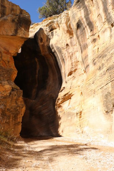
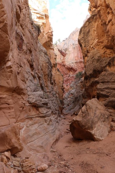
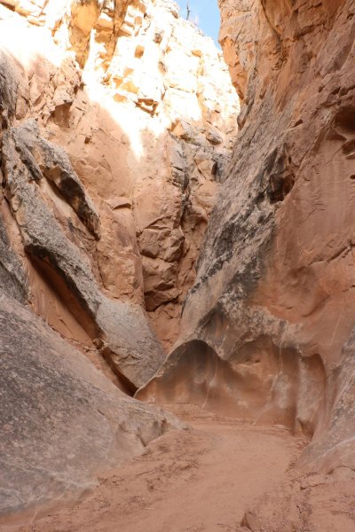
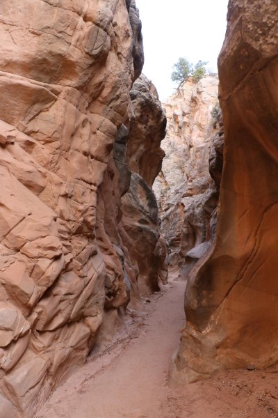
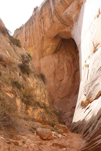
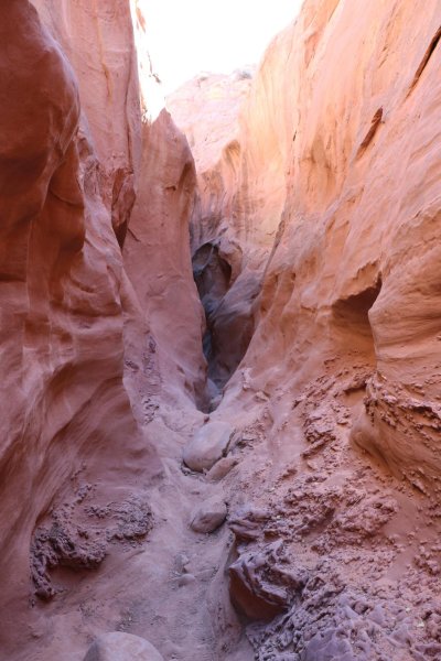
But, if you can stand it, I did another hike into another slot canyon - at the Cottonwood Canyon Narrows. Along the dirt road I drove up to Kodachrome on. This one was dry and again, quite "civilized" with few difficult spots.

The first picture shows the entrance to the canyon, to the west of the dirt road and then the next four are inside the canyon itself. The last one of these shows a shallow, but very tall cave that is being hollowed out on the right wall of the canyon. If I can come back in about a million years, it might have become an arch!

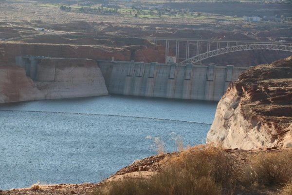
I overnighted both ways at the Whaweap Campground near Page on the banks of Lake Powell, behind Glen Canyon Dam. The last picture shows the water level behind the dam, and you can see how low it is. This area is really suffering from the prolonged drought.

Whaweap Campground is fine, if you like having other campers very close to you. They have both full hookup and "dry" sites and they take reservations.

Anyway, that was my trip. I enjoyed it and am glad to share it with you. The new LiFePO4 battery system with solar worked perfectly.

- Jack
Attached Images
File Type: jpg IMG_1797.jpg (441.6 KB, 3 views)
File Type: jpg IMG_1799.jpg (303.9 KB, 2 views)
File Type: jpg IMG_1801.jpg (278.8 KB, 2 views)
File Type: jpg IMG_1802.jpg (222.5 KB, 2 views)
File Type: jpg IMG_1805.jpg (278.6 KB, 3 views)
File Type: jpg IMG_1808.jpg (265.2 KB, 3 views)
JackandJanet is offline   Reply With Quote
Old 11-02-2023, 10:53 PM   #6
sam
Senior Member
 
Join Date: Mar 2010
Location: Niagara Falls,NY
Posts: 4,224
Default Beautiful pictures.

Glad you had a trouble free trip. I got tired reading about your hikes. Thanks for posting. Something to keep us going in the cold North at 47*
sam is offline   Reply With Quote
Old 11-02-2023, 11:02 PM   #7
Senior Member
 
Angel's Avatar
 
Join Date: Feb 2012
Location: Southern California
Posts: 173
Default

Jack, thank you for sharing the beautiful pictures of your Utah trip, it must have been an awesome camping trip!!
BTW, nice post on the Lithium Battery conversion.
Angel is offline   Reply With Quote
Old 11-03-2023, 05:20 PM   #8
Site Team
 
JackandJanet's Avatar
 
Join Date: Jul 2010
Location: Pine, AZ
Posts: 4,692
Default

Thank you both for your kind words. Sam, I commented to a somewhat younger woman that I met on the trip to the falls that, "I was too old for this," or something to that effect. She replied, "But you're out here!"

That just about sums it up. You gotta keep on movin', if you plan to stay alive.

Angel, I think the LiFePO4 conversion is working very well so far. Of course it's still quite new and I may discover things I don't like about it, but I'm really optimistic.

- Jack
JackandJanet is offline   Reply With Quote
Old 11-09-2023, 06:36 PM   #9
Member
 
Join Date: May 2013
Location: Grand Prairie, Tx. Lake house East Tawakoni, Tx.
Posts: 22
Default magnificent

Thanks for the share of your Hi-Lo Outing.
dallasnarc is offline   Reply With Quote
Old 11-09-2023, 06:56 PM   #10
Senior Member
 
Join Date: Sep 2011
Location: Charlotte, NC
Posts: 151
Default

Beautiful! Thanks for sharing!
__________________
Elaine and Bill Stevenson
Former HiLo-Classic 310S
2011 Toyota Sequoia
Elaine and Bill is offline   Reply With Quote
Old 11-09-2023, 10:16 PM   #11
Member
 
Join Date: Jul 2019
Location: NJ
Posts: 85
Default Thanks Jack

For sharing the photos. I love the west and south west, but it’s a long drive/tow from South Carolina. My daughter and I flew to cali in early May so I could let her see the super waterfalls after a record snow fall season in the Sierra. Mid week in the park was fine, I love staying in Curry Village.
Maybe next spring I will hitch up the 2203T and head for Moab and Arches for a long road trip!
Tom
Trblandy is offline   Reply With Quote
Old 11-11-2023, 09:30 AM   #12
Member
 
Snappy Tom's Avatar
 
Join Date: Sep 2010
Location: Tennessee
Posts: 72
Default

Thanks for sharing your adventures and all the great photos! I used to live in Utah and New Mexico and miss being able to explore there. (We now live in Tennessee). That sunset shot is spectacular! The best sunsets are in the southwest!!!

Marissa
Snappy Tom is offline   Reply With Quote
Old 11-13-2023, 06:32 PM   #13
Member
 
Join Date: Jul 2020
Location: NV
Posts: 39
Default

Wow! Beautiful!
__________________

kebideplin57 is offline   Reply With Quote
Reply


Posting Rules
You may not post new threads
You may not post replies
You may not post attachments
You may not edit your posts

BB code is On
Smilies are On
[IMG] code is On
HTML code is Off
Trackbacks are Off
Pingbacks are Off
Refbacks are Off


» Featured Campgrounds

Reviews provided by

Powered by vBadvanced CMPS v3.2.3
Disclaimer:

This website is not affiliated with or endorsed by Hi-Lo Trailers Worldwide or any of its affiliates. This is an independent, unofficial site.


All times are GMT -5. The time now is 04:14 AM.


Powered by vBulletin® Version 3.8.8 Beta 4
Copyright ©2000 - 2024, vBulletin Solutions, Inc.
HiLoTrailerForum.com Copyright 2010
×