Some Pictures From The North Rim

JackandJanet

Senior Member
Site Team
Joined
Jul 5, 2010
Messages
4,712
Location
Pine, AZ
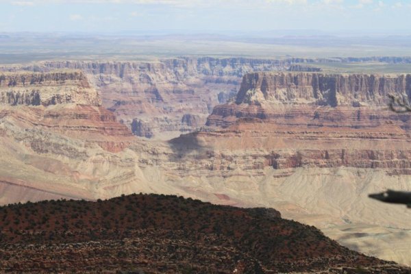
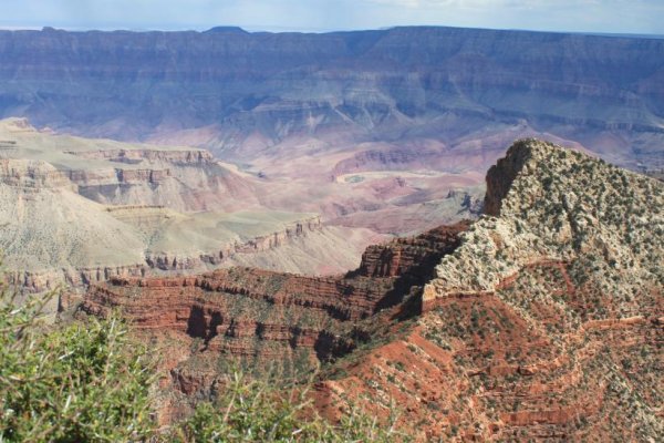
A little over a month ago, Janet and I spent a week in the campground at the North Rim of the Grand Canyon. For those that have never been there, it's far less populated, so, in my opinion, it's more relaxing. Some people don't like the fact that there are only a couple places where you can see the Colorado River from the North Rim, but that's not a biggie to us. There are many hiking trails through the trees on the North Rim with good views of the Canyon and the elevation changes are not too severe on those trails.

The campground is pleasant with flush toilets and a shower and laundry facility nearby. They have a dump station, but no electrical hookups. The water comes directly from Roaring Spring partway down the north face, and it's perfect.

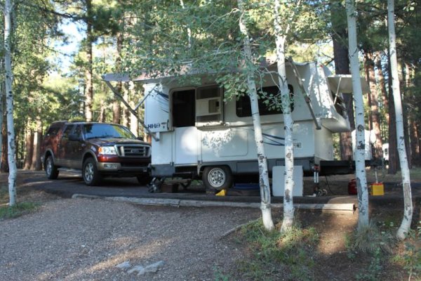
Many camping spots are "drive-through" and ours was one of them.

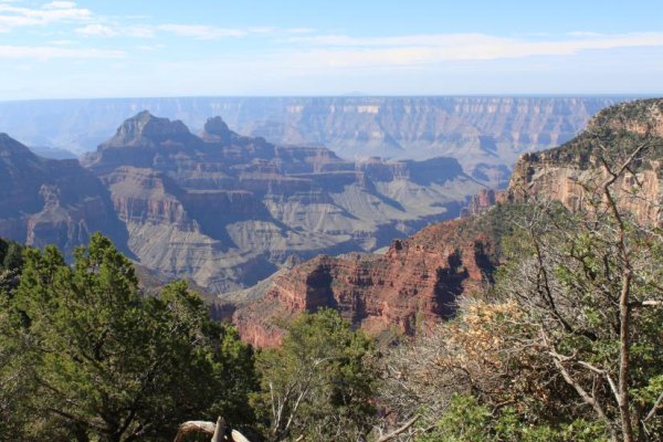
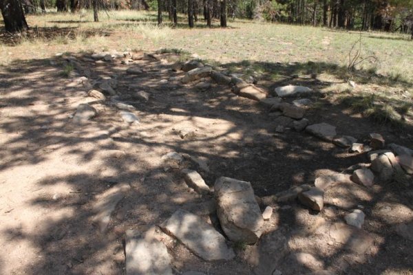
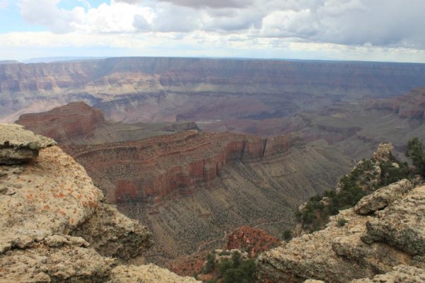
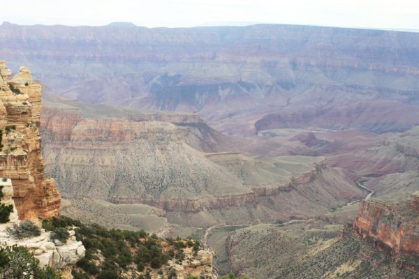
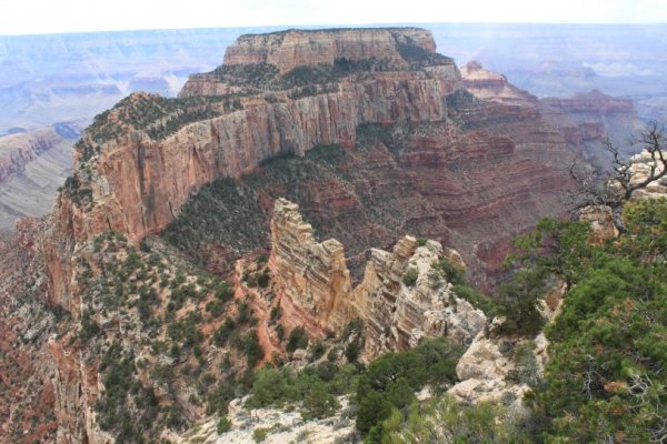
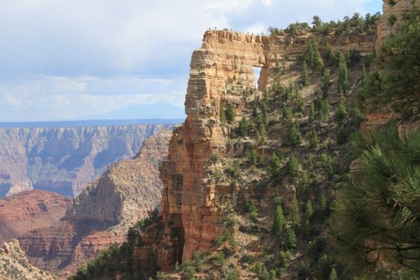
The second picture was a view from the Transept Trail, that runs along the rim from the campground over to Grand Canyon Lodge at Bright Angel Point. The third is an Indian ruin along the Transept Trail. It's not much to look at, but it proves people lived there once.

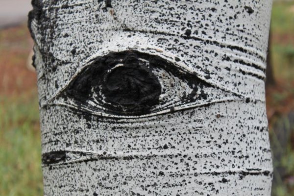
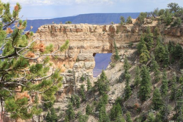
The picture that looks like an "eye" is an aspen tree eye - a point where a branch used to be when the tree was young. They lose their lower branches as they grow.

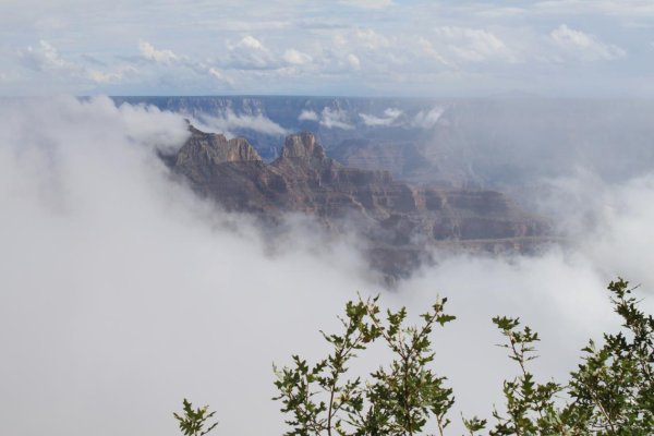
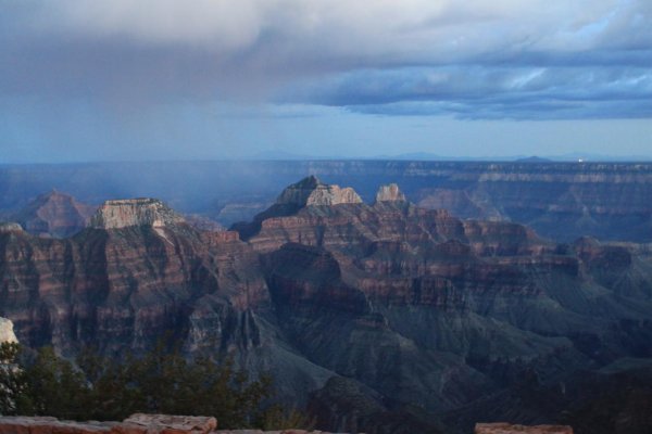
The last picture was a rare event - clouds in the Canyon. This was taken from the Grand Canyon Lodge as the Canyon was starting to clear.

More in the next post.

- Jack
 

Attachments

  • IMG_3921.jpg
    IMG_3921.jpg
    102.7 KB · Views: 102
  • IMG_3923.jpg
    IMG_3923.jpg
    98.6 KB · Views: 82
  • IMG_3930.jpg
    IMG_3930.jpg
    98.8 KB · Views: 77
  • IMG_3936.jpg
    IMG_3936.jpg
    100.9 KB · Views: 83
  • IMG_3942.jpg
    IMG_3942.jpg
    85.5 KB · Views: 74
Last edited:
More Canyon Memories

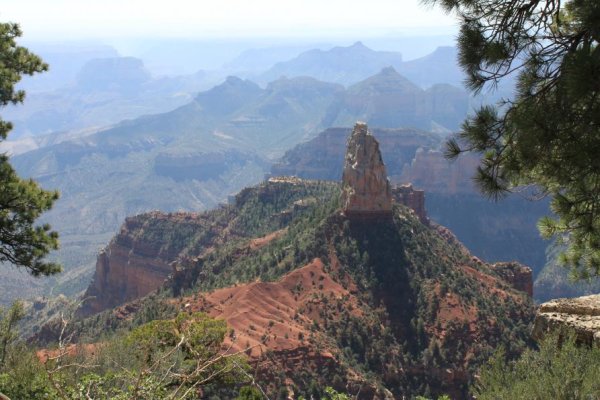
The first is a view from Imperial Point - the highest spot on the North Rim and on the eastern slope. I think the elevation here was about 8800 feet. The second is also from Imperial Point, looking up toward Lee's Ferry. There's a trail down into the Canyon at this viewpoint (which we did NOT take).

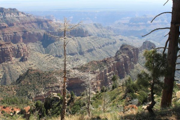
The third is from another viewpoint that is along the road south of Imperial Point. That is not the Colorado River at the bottom, it's just a dry wash.

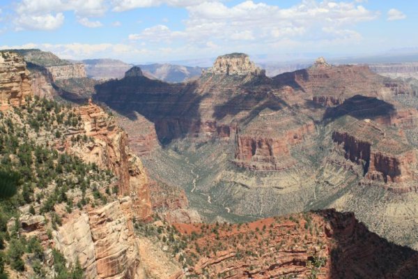
The fourth is from a viewpoint along the trail out to Cape Final. It's a pleasant walk through the woods that's about a 4.5 mile round trip. This is where the Little Colorado River joins the Colorado. The Little Colorado is in the Navajo Reservation.

The last is from Cape Final and is one of the few places where you can see the Colorado. It's near the upper center of the picture. The Canyon bends from a north-south heading here to a west heading.

More in the next post.

- Jack
 

Attachments

  • IMG_3945.jpg
    IMG_3945.jpg
    98.7 KB · Views: 42
  • IMG_3946.jpg
    IMG_3946.jpg
    98.9 KB · Views: 40
  • IMG_3962.jpg
    IMG_3962.jpg
    99.4 KB · Views: 36
  • IMG_3967.jpg
    IMG_3967.jpg
    96.5 KB · Views: 37
  • IMG_3972.jpg
    IMG_3972.jpg
    97.4 KB · Views: 38
Last edited:
Yet More From the North Rim

The first is from Cape Royal, which has viewpoints a short distance from vehicle parking. You can see a river delta on the Colorado near the right center of the picture where the Indians used to spend their winters. They lived up on the rim just behind us during the summers. No one knows for sure how they made the journey down and back up. No trails have been located.

The second is Angels Window at Cape Royal. As you can tell, there is a trail out over it to a viewpoint, which we took. Nice dropoff on all sides there. The third is another view of the delta in the Colorado from on top of the viewpoint over Angels Window.

The fourth picture is Wotans Throne, from Cape Royal and Indian artifacts have been found on it! How they got there is a total mystery to me.

The last is another picture of Angels Window, and it shows why you can't be too afraid of heights if you're out there on it.

More to come.

- Jack
 

Attachments

  • IMG_3974.jpg
    IMG_3974.jpg
    96.5 KB · Views: 34
  • IMG_3978.jpg
    IMG_3978.jpg
    101.4 KB · Views: 34
  • IMG_3982.jpg
    IMG_3982.jpg
    100 KB · Views: 31
  • IMG_3986.jpg
    IMG_3986.jpg
    98.6 KB · Views: 32
  • IMG_3989.jpg
    IMG_3989.jpg
    97.1 KB · Views: 30
And Yet More

I include this one just because it's "pretty". It was a bit after sunset and there is a small rain shower over the Canyon. It was taken from the Canyon Lodge.

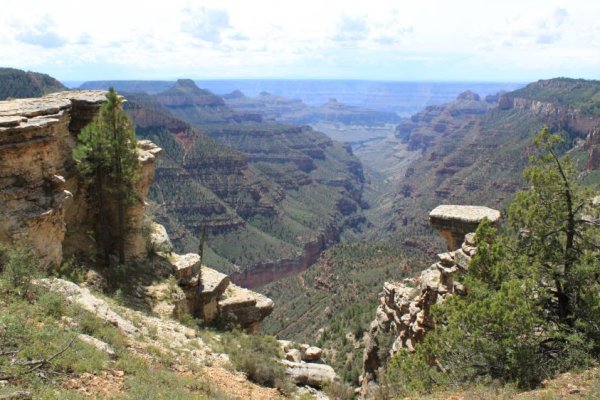
The next is from a stop along the road out to Point Sublime, which was a bit of an "adventure". It is a 17 mile trip on a mostly one-lane 4WD road that has some pretty steep ups and downs along the hillsides. Fortunately, we met very little traffic and there were wide spots where we met them. If we'd been unlucky, someone would have had to back up 1/4 to 1/2 mile to reach a passing point. The canyon you're looking down is bounded on the left by a formation called Dragon Head.

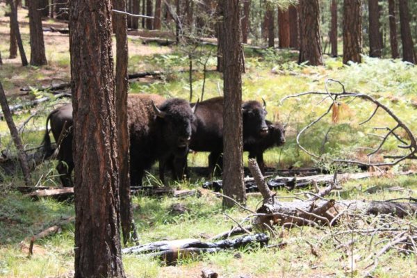
A little further along the "road", we encountered a herd of what look like bison, but are actually "cattelos", a bison-bovine hybrid that were unsuccessful because they would not stay where the breeder wanted to keep them. This experiment was tried in the early 20th century and now they are somewhat of a "pest" on the North Rim. Trouble is, no one wants them, and the Park Service has not really decided how to deal with them. The herd we encountered had at least 50 individuals, and this is just three of them.

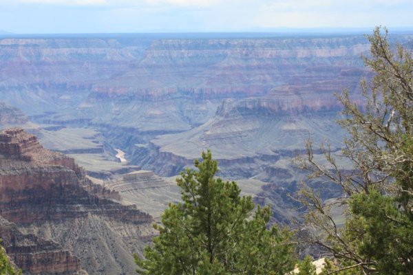
Next, a view from Point Sublime, and again you can see the Colorado River. We were the only ones there, and had a peaceful picnic lunch. While we were there, we saw two rafting parties on a trip down the river.

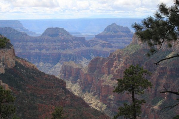
Finally, a view from along the Widforce Trail, that is just to the east of the campground. We walked out about 2 miles along this trail and saw three deer and a couple wild turkeys, but I was not able to get a good picture of either of them.

And, with this post, I think I've subjected you to enough! Hope it was not TOO grueling.

- Jack
 

Attachments

  • IMG_3993.jpg
    IMG_3993.jpg
    88.7 KB · Views: 40
  • IMG_3995.jpg
    IMG_3995.jpg
    99.2 KB · Views: 42
  • IMG_4001.jpg
    IMG_4001.jpg
    103.8 KB · Views: 53
  • IMG_4009.jpg
    IMG_4009.jpg
    97.4 KB · Views: 42
  • IMG_4013.jpg
    IMG_4013.jpg
    96.3 KB · Views: 41
nice narrative and good pics.
Such a picturesque place and awe inspiring.
Thank you for sharing.

steve
 
Thanks, guys. This was our second trip to the North Rim. It's really a nice place to spend a quiet time and learn things from the Rangers.

- Jack
 
Great pictures Jack, we live in New River AZ,the North Rim is on our camping list for next year. How long was the drive up? How far out did you book your campsite? Terry and Lauire
 
Great pictures Jack, we live in New River AZ,the North Rim is on our camping list for next year. How long was the drive up? How far out did you book your campsite? Terry and Lauire

Thanks Terry. The drive was pretty easy, about 5 hours from Pine. The most difficult part is the weird track you have to make at Flagstaff to get onto I-40 on the way up or back off of it on the return. We stopped for lunch at Cameron Trading Post, where we talked to a Navajo rug weaver who was nearly finished with an absolutely beautiful HUGE rug that she was making on commission as a king-sized bedspread. I have never seen a tapestry that was more perfect or complicated than that one. I should have taken a picture, but my camera was in the truck.

I made the campground reservations in May, and we camped there in the last part of August. Even with that lead time, the choices were fairly limited. I would suggest you try to reserve at the earliest possible time, to get a good choice of campsites. In our opinion, the sites that are on the outside of the outer ring are the nicest. The ones on the south end of the campground are on the rim. We were on the west side, in site #6.

- Jack
 
Jack, your pics are marvelous. From your pics, it seems that the North Rim is not as "touristy" as the South Rim. I like that. However, you said that camp site reservations need to be made pretty far in advance, so I guess the word is getting out about your little slice of heaven. We're on the U.S. East coast and will be flying out in June 2015 for five weeks with other family members. No camping this time; where is the nearest lodging to the Grand Canyon North Rim?

Dee
 
Hi Dee -

Yes, the North Rim is not nearly as touristy as the South. I seem to remember, from something a Ranger said, that the North RIm gets only 10% of the total visits to the Grand Canyon National Park.

The nearest lodging is at the North Rim itself, through the Grand Canyon Lodge and the cabins that are there. We talked to a couple who had a "view cabin" (right on the rim, with a covered deck that overlooked the Canyon) and I THINK they said the fee was between $200-250 per night. Other lodging is in the $120 price range, I think, depending on the size of the cabin. We stayed in a cabin on the South Rim, right at the start of Bright Angel Trail, several years ago and it was very comfortable. However, like camping, reservations need to be made in advance and the sooner the better. I don't know when the reservation window opens for a June 2015 visit, but I suspect you could find out on the Canyon website.

There's a very little town called Jacob Lake about 60 miles north of the North Rim entrance and they have an inn, called "Jacob Lake Inn". I know nothing about their rates or what advance notice you have to work with for reservations. I suspect they would be a bit less expensive than the cabins on the Rim though. We generally make a refueling stop in Jacob Lake, and it seems to be a pleasant place. The drive to the North Rim from there is very nice. You often see cattelo herds on that route.

- Jack
 
Jack, thanks for the info. Another question. As a general rule, when does the ice and snow weather leave the North Rim area for a significant period of time? Remember, this question is coming from someone who has lived all of her life in the southeastern U.S. with no snow and does not know how to drive in that type of weather and getting too old to learn. We can take the cool weather, but not ice and snow.

Dee
 
Thanks Terry. The drive was pretty easy, about 5 hours from Pine. The most difficult part is the weird track you have to make at Flagstaff to get onto I-40 on the way up or back off of it on the return. We stopped for lunch at Cameron Trading Post, where we talked to a Navajo rug weaver who was nearly finished with an absolutely beautiful HUGE rug that she was making on commission as a king-sized bedspread. I have never seen a tapestry that was more perfect or complicated than that one. I should have taken a picture, but my camera was in the truck.

I made the campground reservations in May, and we camped there in the last part of August. Even with that lead time, the choices were fairly limited. I would suggest you try to reserve at the earliest possible time, to get a good choice of campsites. In our opinion, the sites that are on the outside of the outer ring are the nicest. The ones on the south end of the campground are on the rim. We were on the west side, in site #6.

- Jack
Thanks for sharing Jack. Linda and I made the trip from Bryce Canyon to the North rim one day about ten years ago, and since we were there only for the day we did not see all you experienced. We did hike down a trail that was shared with the mule riders, and I will say that was a strenuous hike ten years ago. Just thinking about the hike now wears me out!:D
 
Thank you Jack for all the information on the North Rim campground. I will try to get one of the outside sites. My son, next weekend, is going to take the Hi Lo down to Kartchner Caverns State Park campground for the weekend. The trailer so far is getting alot of use! Really enjoying it. Thank you again Jack.
Terry and Laurie
 
Jack, thanks for the info. Another question. As a general rule, when does the ice and snow weather leave the North Rim area for a significant period of time? Remember, this question is coming from someone who has lived all of her life in the southeastern U.S. with no snow and does not know how to drive in that type of weather and getting too old to learn. We can take the cool weather, but not ice and snow.

Dee

Your reluctance to drive in snow and ice is very warranted in this area Dee. A slide off the road could result in an up close view of the canyon bottom. I learned to drive in snow and ice in a semi truck as we don't have it here in South Texas. First time it snowed when I was driving, I didn't realize what is was till it began piling up on my wipers. Sad but true. Snow is not fun. Glad to be a southerner.
 
Thanks for sharing Jack. Linda and I made the trip from Bryce Canyon to the North rim one day about ten years ago, and since we were there only for the day we did not see all you experienced. We did hike down a trail that was shared with the mule riders, and I will say that was a strenuous hike ten years ago. Just thinking about the hike now wears me out!:D

Good God! I think you went down the North Kaibab Trail, that ultimately takes you to Phantom Ranch. I don't know how far you went - Janet and I only went down about 1/2 mile, but that is a steep trail! I would have liked to see Roaring Falls, but, as I recall, it's about 4-5 miles down, and about three thousand feet change in elevation.

About ten years ago was when we stayed on the South Rim. I hiked about halfway down the South Kaibab trail and that was a killer! It's the shortest trail to Phantom Ranch, but it starts about one thousand feet higher than Bright Angel trail.

- Jack
 
Jack, thanks for the info. Another question. As a general rule, when does the ice and snow weather leave the North Rim area for a significant period of time? Remember, this question is coming from someone who has lived all of her life in the southeastern U.S. with no snow and does not know how to drive in that type of weather and getting too old to learn. We can take the cool weather, but not ice and snow.

Dee

Dee - I can't answer that question, but food and lodging is open on the North Rim from May 15 to Oct 15. I think you CAN get snow later than May 15, but I would not expect it to last long or to be heavy. I think June would be fine. They close the road into the Canyon during the winter.

Here in Pine, elevation 5700 feet, the snow is pretty much over at the end of February.

- Jack
 
Thank you Jack for all the information on the North Rim campground. I will try to get one of the outside sites. My son, next weekend, is going to take the Hi Lo down to Kartchner Caverns State Park campground for the weekend. The trailer so far is getting alot of use! Really enjoying it. Thank you again Jack.
Terry and Laurie

Terry, I think you're going to really like Kartchner Caverns. I've been there twice, and I can tell you it's a MAJOR cave! It's also "wet" - meaning it's still evolving and you go through airlocks that preserve the humidity when you enter.

There are two different sections of the cave that are open to the public. Unfortunately, I've only seen one. They close one of them during the season when bats are using it as a nursery.

- Jack
 
Good God! I think you went down the North Kaibab Trail, that ultimately takes you to Phantom Ranch. I don't know how far you went - Janet and I only went down about 1/2 mile, but that is a steep trail! I would have liked to see Roaring Falls, but, as I recall, it's about 4-5 miles down, and about three thousand feet change in elevation.

About ten years ago was when we stayed on the South Rim. I hiked about halfway down the South Kaibab trail and that was a killer! It's the shortest trail to Phantom Ranch, but it starts about one thousand feet higher than Bright Angel trail.

- Jack
I wish I could remember what trail we were on, and it was strenuous, but we went down as far as the mules went before they turned around and went back up. If we had gone farther down, we would have been hugging the cliff walls on a good portion of the trail.:D
 

New posts

Try RV LIFE Pro Free for 7 Days

  • New Ad-Free experience on this RV LIFE Community.
  • Plan the best RV Safe travel with RV LIFE Trip Wizard.
  • Navigate with our RV Safe GPS mobile app.
  • and much more...
Try RV LIFE Pro Today
Back
Top